|
Jinyuan Shao 邵金圆 I received my PhD from Purdue University and my M.S. from the Chinese Academy of Sciences. During my PhD, I first introduced the concepts of super-resolution and understory removal for forest LiDAR point cloud processing. Please feel free to reach out if you have any questions about my research or are interested in potential collaborations. Email | CV | GitHub | Google Scholar | LinkedIn |

|
| News |
|
Jan 2026: 📜 One paper has been accepted for publication by Remote Sensing of Environment! |
|
Sep 2025: 🌟 I was selected as the Purdue Ag Graduate Spotlight of September! (Article) |
|
Jan 2025: 🏆 Win the first place in ASPRS 2024 GeoChallenge as the team leader! (Announcement; News) |
| Research |
|
|
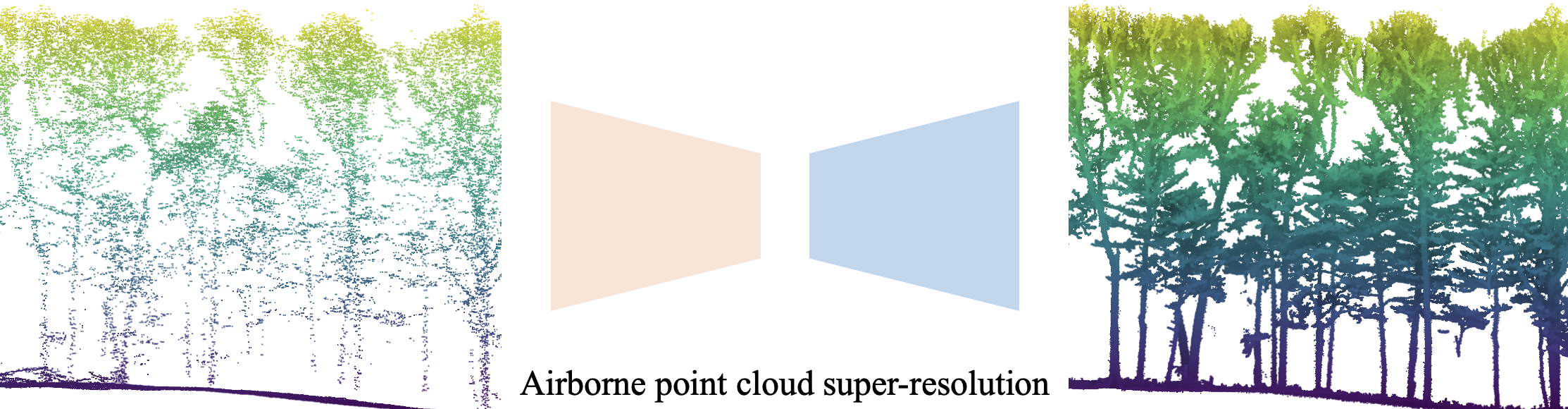
Super-Resolution of Airborne Laser Scanning Point Clouds for Forest Inventory
Jinyuan Shao, Sangyoong Park, Chunxi Zhao, Ayman Habib, Songlin Fei arXiv preprint, 2026 paper |
|
|
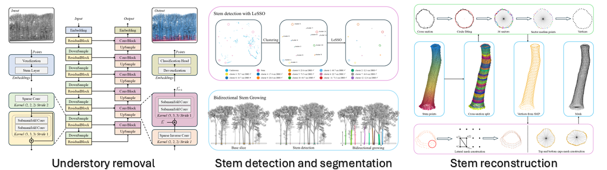
A three-stage framework for stand-level automated stem volume estimation in temperate forests using mobile laser scanning
Jinyuan Shao, Dennis Heejoon Choi, Jidong Liu, Xiangxi Tian, Bina Thapa, Seunghyeon Lee, Ayman Habib, Songlin Fei Remote Sensing of Environment (RSE), 2026 |
|
|
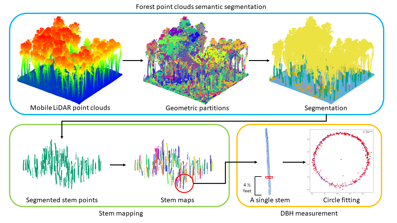
Large-scale inventory in natural forests with mobile LiDAR point clouds
Jinyuan Shao, Yi-Chun Lin, Cameron Wingren, Sang-Yeop Shin, William Fei, Joshua Carpenter, Ayman Habib, Songlin Fei Science of Remote Sensing (SRS), 2024 poster |
|
|
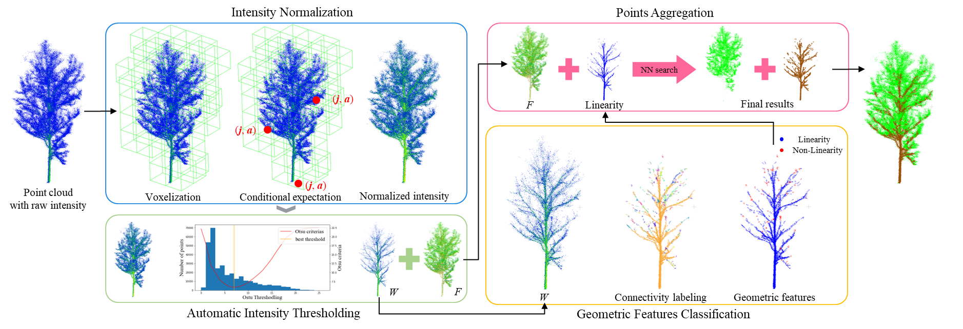
Radiometric and Geometric Approch for Major Woody Parts Segmentation in Forests LiDAR Point Clouds
Jinyuan Shao, Yi-Ting Cheng, Yerassyl Koshan, Raja Manish, Ayman Habib, Songlin Fei IEEE International Geoscience and Remote Sensing Sypossium (IGARSS), 2023 poster |
|
|
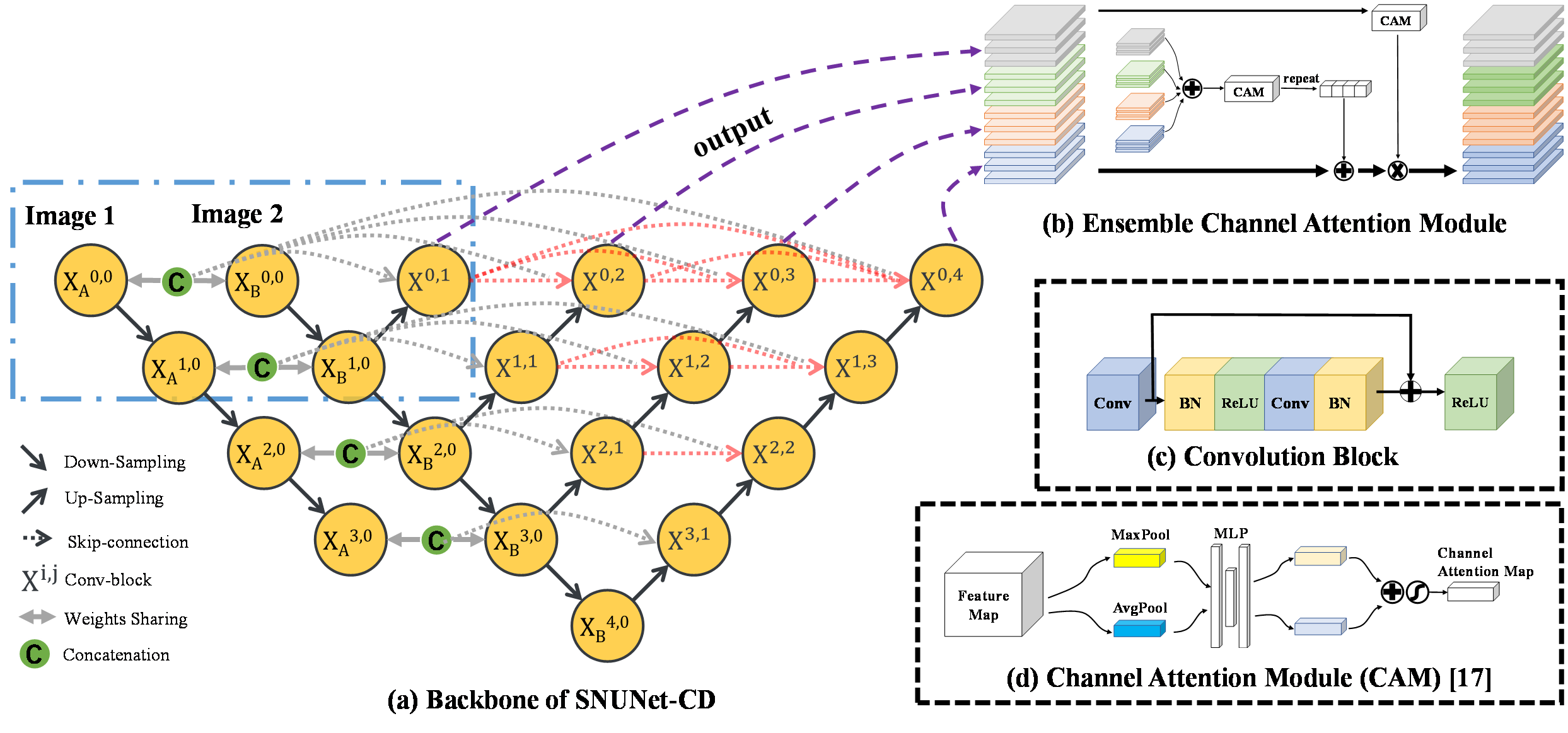
SNUNet-CD: A Densely Connected Siamese Network for Change Detection of VHR Images
Sheng Fang, Kaiyu Li, Jinyuan Shao, Zhe Li, IEEE Geoscience and Remote Sensing Letters (IEEE GRSL), 2021 code |